This story was originally published by The Guardian and appears here as part of the Climate Desk collaboration.
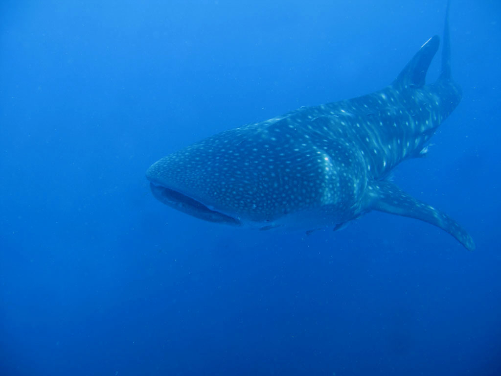
"It’s a fantastic experience to be next to a 12-metre-long whale shark, or to get close to a predator like a tiger shark,” says the marine scientist Alex Hearn. “Nothing quite measures up to slipping into the water and swimming alongside one of these incredible creatures.”
Most days, however, Hearn, a biology professor at Universidad San Francisco de Quito in Ecuador, is at his desk grappling with algorithms in an attempt to protect the world’s oceans. Hearn is a marine planner — like a city planner, but for the sea.
As with urban planning, Hearn’s is a technical job, taking complex datasets collected from surveys and scientific studies and processing them using software to find solutions to specific questions: how space is used, what can be built and which areas need to be protected. Each decision is a delicate balancing act that involves having to consider the needs of many different parties, from businesses to local people — which at sea also means those with scales, fins, shells and tentacles.
As space in the world’s oceans comes under pressure, marine spatial planning is becoming increasingly important to protect ecosystems, as well as balancing the needs of marine life with human activities, such as fishing, energy, tourism and shipping. Hearn has spent the past three years working on a marine spatial plan looking at ocean protection around the Galápagos, which has led to Ecuador, Panama, Colombia and Costa Rica joining their marine reserves to form one interconnected area — with Ecuador’s government expanding its existing Galápagos marine reserve by 60,000 sq m.
“In the case of the Galápagos, marine spatial planning was born from a cauldron of concerns,” says Hearn. “All levels of society have a stake, from local fishers to the government.”
One question Hearn and his team of international scientists and researchers examined was how to protect migratory routes for sharks, turtles and other species. To find out about the routes they had to tag sharks. “We go out, catch them, bring them alongside the boat, attach satellite tags, then let them go and track them,” he says. After which it is back to his desk and time to use the data to find ways to protect the ocean while keeping local communities, businesses and the government happy.
His team use Marxan, a suite of software tools, to determine which are the best areas to protect. “It prioritizes where you might want to carry out conservation actions — in this case, to create an MPA [marine protected area] —by annoying the smallest number of people,” says Hearn. “We wanted to protect certain species, their migratory pathways and offshore foraging areas, and to protect highly productive habitats.”
The algorithm factors in the cost of protection — i.e., the loss of fishing opportunities. There are two main fleets operating in the area, so Hearn and his team took 10-year-old data about catches and put a dollar value on each location. “You’re trying to work out, ‘Where can I protect 50 per cent of our hammerhead shark grounds and minimize the impact on the longline fleet?’ You’re trying to maximize conservation at the minimum cost.”
The data fed into Marxan came from many sources, including scientists and research teams who have spent years out on the ocean — including one that tags albatrosses and another that studies sea turtles. “The person doing the Marxan number-crunching was in York, in the U.K.,” says Hearn.
According to Hearn, marine planning can be “very political”, as well as frustratingly slow. As with city planning, there is a huge amount of bureaucracy. Not everyone is keen to help, either. When they tried to get fishing data from the Galápagos’s Vice-Ministry of Fisheries, Hearn says they were “stonewalled … so we had to work on older datasets.”
There’s also the need for incredible attention to detail — checking and rechecking numbers. “There’s a lot of computer time,” he says. “It can be tedious and sometimes fraught, but that is the process.”
Sarah Brooks, another marine planner, knows how that feels. Though she has spent plenty of time on and in the ocean, including sailing around the world, her work now involves far more screen time. “My job is incredibly desk-based,” says the marine spatial planning specialist, who has been working on the Bermuda Ocean Prosperity Programme since September 2020.
Brooks takes data from scientists, divers, fishers and others who use the water. “My job is to get that info from them in a way that’s useful for marine spatial planning.” She transforms it using tools including Prioritizr, software that helps her create detailed ocean maps to show the best areas for marine life, such as fish or coral. Brooks produces what look like heat maps of Bermuda’s ocean. “The darker the red, the better the abundance or diversity,” says Brooks.
As with Ecuador, Bermuda has different interests jostling for ocean space. Brooks works with 19 organizations to meet the needs of residential areas, tourism, fishers, shipping, and utilities — such as cables or pipelines in the water — and marine life. Her marine spatial plan helps guide decisions on how space is allocated, including potential sites for offshore windfarms, as part of the Bermudan government’s target of 85 per cent renewable energy by 2035. To do this they rule out areas that are too shallow, too close to the shore or airport, important seagrass beds and coral reefs, as well as the most important fishing grounds.
“We give the rest of the space a suitability index, from ‘least suitable’ to ‘most suitable’,” says Brooks. This produces a heat map to show the best areas for a particular project. “A developer would still need to do feasibility studies and environmental impact reports, but it’s a starting point,” she says.
The work can be frustrating. Much like urban planning, there are rules and regulations, piles of paperwork and plenty of red tape. “There’s a lot of legislation,” says Brooks. “It’s not like one or two people make a decision and you run with it. You’ve have consultation with a lot of different people, which can hold things up.” Creating a draft marine spatial plan policy document for Bermuda has already taken two and a half years, and it isn’t over the line yet.
Patience is key to surviving as a marine planner. In the Galápagos, the Ecuadorian government opted for much smaller protected areas than Hearn and his team recommended. “We proposed addressing things like illegal fishing in the Galápagos, and climate change, but this MPA focuses on migratory routes,” he says. “We’re happy with what we got, as a first step.”

Marine planning is also rewarding and essential, says Hearn. “It needs to be done. We’re not living in a sustainable fashion as a global society. I always wanted to muck in, and the way I saw I could contribute was to help steer us towards a more sustainable economy and help keep oceans healthy for future generations.”


Comments