Support strong Canadian climate journalism for 2025
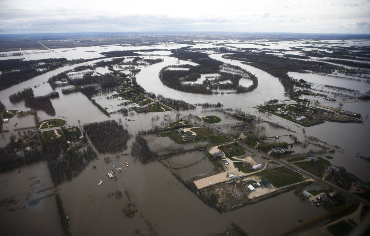
Manitoba's premier and transportation minister shared a helicopter with the Opposition leader for a tour of flooded regions south and north of the provincial capital on Sunday, where water levels appear to have crested or are on their way down.
But they noted heavy rain on Friday in the west, combined with melting snow, has washed out roads in Duck Mountain Provincial Park and has affected bridges on Highway 10 north and south of the community of Mafeking.
Transportation and Infrastructure Minister Doyle Piwniuk told reporters that another "Colorado Low" deluged western Manitoba and eastern Saskatchewan with close to 75 millimetres of rain, with some higher elevations receiving over 125 millimetres.
The province's Hydrologic Forecast Centre has issued an overland flood warning for the Parkland, which includes those areas, noting that downstream communities could be affected before all the water reaches Dauphin Lake or Lake Winnipegosis.
Premier Heather Stefanson said Sunday's helicopter tour took them south of Winnipeg over the Red River Valley, where she said water is dropping in the Emerson area and is cresting in St. Adolphe.
They also flew north over the Peguis area where some 1,800 people have evacuated homes on the Peguis First Nation, and Stefanson says the water levels there have dropped significantly since she visited the area a couple of weeks ago.
"We're hoping there's not another Colorado Low coming our way," Stefanson said in front of a red helicopter under bright skies, standing alongside Piwniuk and NDP Leader Wab Kinew.
"Weather like this would be very good, and quickly, so that farmers can get into their fields."
Kinew noted it was important for political leaders to work together during the disaster. He also said that government investments will be needed to tackle the problem, adding it's beyond the abilities of individuals or communities.
"We've seen communities that have been evacuated in some cases, others that look like islands in the middle of a lake, which would normally be the Red River," Kinew said.
Johanu Botha, head of emergency management, said nearly 2,500 people in the province are currently evacuated due to flooding, including just under 2,000 from First Nations.
The province said in a flood bulletin Sunday that the Red River peaked May 13 at Ste. Agathe, St. Adolphe and at the inlet for the Red River Floodway, which diverts floodwater around Winnipeg. The bulletin also said levels are stable or declining at all locations upstream of Winnipeg.
However, it said the river is expected to remain high for an extended duration, likely into June.
Provincial crews have been deployed to assess the full impact of the weather system that hit Parkland, the bulletin said, and they will respond as required.
It also asked motorists who are not in the Parkland region to avoid the area.
This report by The Canadian Press was first published May 15, 2022.


Comments