Support strong Canadian climate journalism for 2025
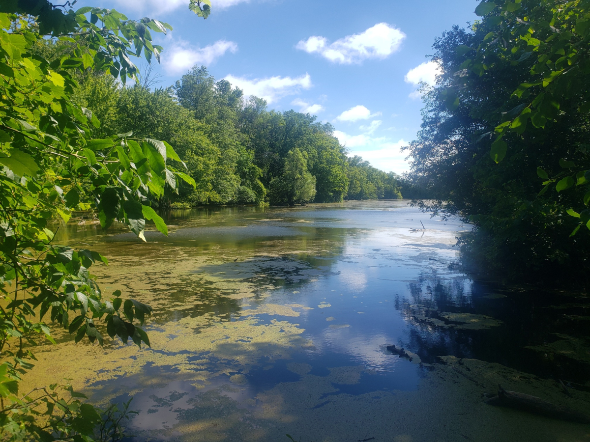
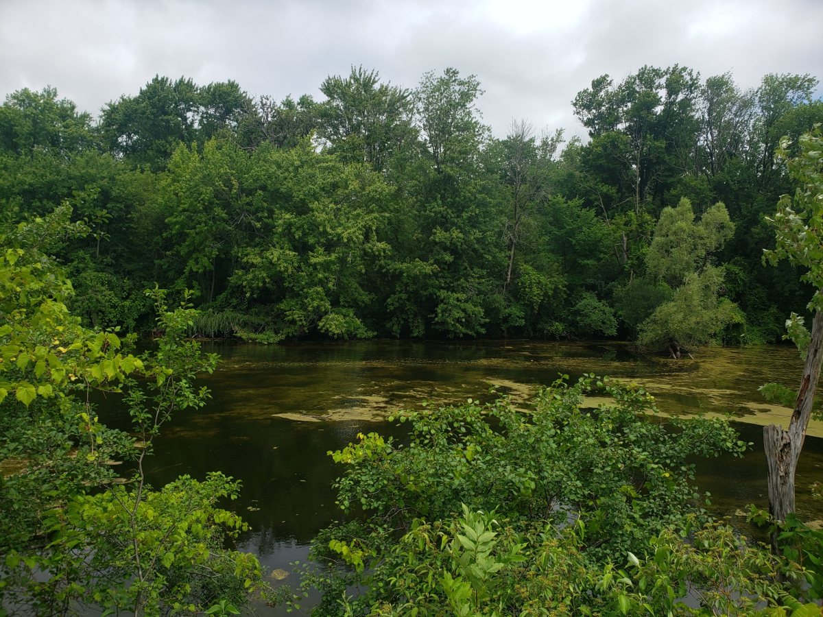
Two swampy wetland areas nestled in the heart of the Duffins Rouge Agricultural Preserve have become ground zero in the battle against Premier Doug Ford's plan to develop a chunk of Ontario's Greenbelt lands. The preserve, known as DRAP, shares its western border with Rouge National Urban Park, Canada’s largest urban park.
A new report from the Wildlands League, shared exclusively with Canada’s National Observer, warns the development of DRAP will compromise the ecological integrity of Rouge National Urban Park.
The report specifically identifies two vulnerable wetland areas: a treed swamp within DRAP and the Townline Swamp, a provincially significant wetland near DRAP in Pickering. These wetlands serve as crucial connectors for wildlife movement between DRAP and the park, establishing essential links from the Greenbelt to Lake Ontario, says the report.
The report also emphasizes the importance of preserving natural habitat patches — such as woodlots, wetlands and hedgerows — because they play a vital role in preventing biodiversity loss in urbanized landscapes.
“If these patches were to be invaded by urban sprawl, animals will no longer be able to move safely between the Rouge and Duffins Creek. In some cases, populations may be extirpated,” said Dave Pearce, the Wildlands League’s senior forest conservation manager. “These habitat patches, like stepping stones crossing a swift current, allow wildlife to move where they otherwise couldn’t and help species to find the various habitats they need to survive.”

Many area residents are passionate about wetlands protection and are dismayed at the thought housing might push them out of existence. “It's a stressful and heartbreaking situation," said June Enright, a resident of Cherrywood, her eyes brimming with tears. After four decades living in the area, she has developed a deep concern for her beloved community and Amos Pond (a small area part of the Townline Swamp Wetland Complex).
“Nature took a significantly longer time to create these wetlands than it ever will to try to restore them,” Enright said. Organizations like the World Health Organization say we are in a climate crisis, she noted. “Every piece of wetland matters,” Enright said. “Our collective health for the planet revolves around preserving these spaces.”
The Duffins Rouge Agricultural Preserve is one of the most ecologically sensitive areas in Ontario. A sprawling 4,700-acre piece of land east of Toronto, it’s home to more than 1,700 species, including 42 considered at risk. Federal Environment Minister Steven Guilbeault ordered an environmental assessment study for the area surrounding Rouge National Urban Park that is to be removed from the Greenbelt. According to Pearce, the assessment will cover the Duffins Rouge Agricultural Preserve, including the two wetland complexes.
Until December 2022, the area was part of Ontario’s Greenbelt, a swath of protected land that includes farmland, forests, wetlands, rivers and lakes. The Ford government removed the land from the Greenbelt to open it up for housing development as part of the province’s commitment to build 1.5 million new homes across the province over the next decade.
Part of that plan involves removing 7,400 acres of protected land from the Greenbelt, which the provincial government rationalizes with its commitment to add another 9,400 acres to the Greenbelt elsewhere.
The two wetlands identified in the Wildlands report are part of an important corridor for the movement of wildlife and water. Species at risk recorded in the Greater Rouge Ecosystem include the western chorus frog, snapping turtle and Blanding’s turtle, according to the report.
The Townline Swamp Wetland Complex, which is close to DRAP in Rouge Park, is considered to be the most ecologically sensitive area, Pearce said. It serves as habitat for numerous endangered and threatened species, including the Blanding’s turtle, bank swallow, red-headed woodpecker, various bat species and other rare species, he added.
“Every turtle in Ontario is at risk. The Blanding’s turtle is highly at risk, and there has been a big effort to reintroduce them into the area. The Toronto Zoo is actually breeding them,” he said.
“Last winter, I saw anywhere from 50 to 60 trumpeter swans in … open water at the mouth of the Rouge,” said Craig Bamford of Pickering, a longtime local environmental advocate and member of Stop Sprawl Durham. “This is just one example of the species that migrate through this narrow corridor. We need to protect it.”
The natural areas should be protected so all residents “have the opportunity to leave our city's houses and visit Rouge Park, enjoy it, and explain it to our children,” he added. This is a place where people can discover what nature is all about, he added. And healthy people make healthy communities and people need places like this to get exercise and stay active, he added.

Increasing biodiversity keeps the ecosystem whole and healthy for everyone, including humans, Pearce said.
The second sensitive area, a treed swamp that lies within DRAP, also serves as a habitat for various species, including the spring peeper frog. Frogs, known for their sensitivity to pollution and environmental changes, act as reliable indicators of a relatively healthy ecosystem, said Pearce. Their presence in the area signifies a minimum level of environmental well-being since frogs cannot survive in polluted water, he noted. This makes them a valuable gauge for assessing the overall ecological condition.
Frogs also play a crucial role in insect control. Their absence could result in an increase in mosquito and bug populations, said Pearce.
Pearce said the Wildlands report chose these two areas for the ecological risk study because they are particularly important “stepping stones” of natural habitat that connect wildlife on a regional scale, he added.
“Premier Doug Ford’s government and developers are threatening prime natural heritage and agricultural lands with needless urbanization. Numerous independent studies show there are plenty of more appropriate areas available for homebuilding,” said Janet Sumner, executive director of the Wildlands League.
Last week, a federal briefing note obtained by Global News stated 29 at-risk species live or are likely to live on every part of the previously protected lands. The note was prepared in March for Guilbeault.
According to Environment and Climate Change Canada, the species at risk include Blanding’s turtles, eastern milksnakes, eastern musk turtles, midland painted turtles and snapping turtles.
Although the federal government has known since March that at-risk species could live in the entire area earmarked for development, so far only one environmental assessment has been ordered, covering only part of the excluded area. In March, the Impact Assessment Agency of Canada told Canada's National Observer that an independent expert committee will conduct the study, and terms of reference for the work will be done by the end of this month. Final results should be in by early 2025, the agency said.
The Ministry of Municipal Affairs and Housing of Ontario says developments will require planning approvals from the municipality, and the province will require that environmentally sensitive areas are set aside and protected before any construction begins.
The provincial government will return lands currently opened up for housing development to the Greenbelt if the conditions set by the government are not met and if progress on new homes does not adequately proceed by 2025, the ministry said.
This story was produced in partnership with Journalists for Human Rights for the Afghan Journalists-in-Residence program funded by the Meta Journalism Project.


Comments
so if developers go full stream ahead and bulldoze the whole area flat over one weekend ( doug’s friends’ preferred method as demonstrated several times in the last few years) then thats ok i guess.
please note that loophole in Todd Smith’s appalling statement.
we need a serious INJUNCTION to make sure that cannot happen!!!
Excellent, practical work by Wildlands League. It expands the spotlight of Ford's destruction of agricultural land, the primary purpose of the reserve, to other unaffordable losses.