Support strong Canadian climate journalism for 2025
A coastal First Nation’s Guardian team is gearing up to test the waters to try to limit the impacts of drought in their traditional territories on northeast Vancouver Island.
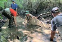
The We Wai Kai First Nation's environmental stewards are partnering with other local groups to map and monitor wetlands, watersheds and streams on Quadra Island as summers get hotter and drier, said Guardian program manager Shane Pollard.
Drought in the northeastern Vancouver Island water basin, which includes We Wai Kai territory and Quadra Island, is increasingly common.
All of B.C. suffered severe drought this summer, but it is the third year running that the island region hit Level 5 on the provincial drought scale — the most extreme rating when adverse impacts on fish health, ecosystems or society are certain.
Quadra Island has a few lakes, but most residents, including folks living on the nation’s Cape Mudge reserve, draw water from wells that need rain or surface water like creeks or wetlands to recharge underground aquifers, Pollard said.
“Everyone is feeling the effects of the lack of rain we are getting,” he said.
“We’re at the point [that] if we want to expand our village, there’s just not enough water to do that and we’d probably have to truck in our own water at some point.”
To protect the island’s groundwater resources, the Guardians are partnering with Quadra Island’s Climate Action Network (I-CAN) and the Salmon Enhancement Society to survey surface water across the island and hopefully identify the areas most important to maintain the water supply for both the people and environmental needs, Pollard said.
The Guardians will get help from a volunteer core of citizen scientists and salmon stream walkers on the island to measure rising or falling surface water levels through the seasons and changing weather.
“But we’ll be doing a lot of the fieldwork,” Pollard said.
“We’ll be the ones who are essentially the boots on the ground.”
Pinpointing which wetlands or watercourses are filtering down into aquifers is one goal, but so is identifying where it’s key to try to maintain water levels for fish habitat, he added.
“Of course, the lack of water in the streams is a big problem for salmon,” Pollard said.
The Guardians will take a look at conditions on Hyacinthe Creek, which supports chum and coho populations, and evaluate other salmon streams during the water survey.
Global warming is causing increasingly dry summers and more intense rains at other times of the year, both of which endanger salmon, said Pollard.
If river levels are too low or water temperatures are too high, spawning salmon can’t or won’t migrate upstream. While floods caused by heavy rain can scour out streams, damaging incubating eggs or habitat important to juvenile fish, he said.
“We’ll just go from one extreme to the other. There’s not enough water or there’s too much.”
Protecting and identifying important cultural sites will also be on the Guardians’ radar during the mapping process, Pollard said.
“Quadra is full of [traditional] clam gardens,” he said. “We actually have a lot of archeological sites around Quadra that I’m hoping we can find and protect more.
“Right now, I’m looking into the past, finding out old village names and what these creeks were used for historically.”
Traditional knowledge from elders will be helpful, but regular monitoring of water sources and creeks has to take place because environmental conditions are shifting so quickly with climate change, Pollard said.
“All of this is kind of new,” he said.
“Knowledge holders didn’t deal with global warming like this, so now we’re trying to figure out exactly what’s going on.
“We’ll pretty much be setting a blueprint with this groundwork, then we can grow from there.”
Rochelle Baker / Local Journalism Initiative / Canada's National Observer


Comments