Support strong Canadian climate journalism for 2025
Large portions of Canada’s vast boreal forest could be at risk of dying off by the end of the century, as climate change will dramatically aggravate the risk of wildfires, drought and insect infestations, say government scientists in a groundbreaking new study.
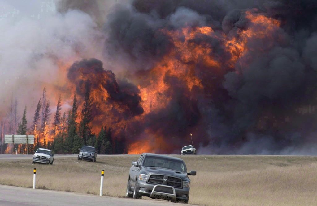
Even by mid-century, parts of Canada’s 270-million hectares of boreal forest that purifies water and air, regulates the climate and stores carbon will already be at heightened risk of devastating fires like the ones seen in Fort McMurray, Alberta in 2016, the Northwest Territories in 2014 and the James Bay area in 2013, according to scientists in the Canadian Forest Service.
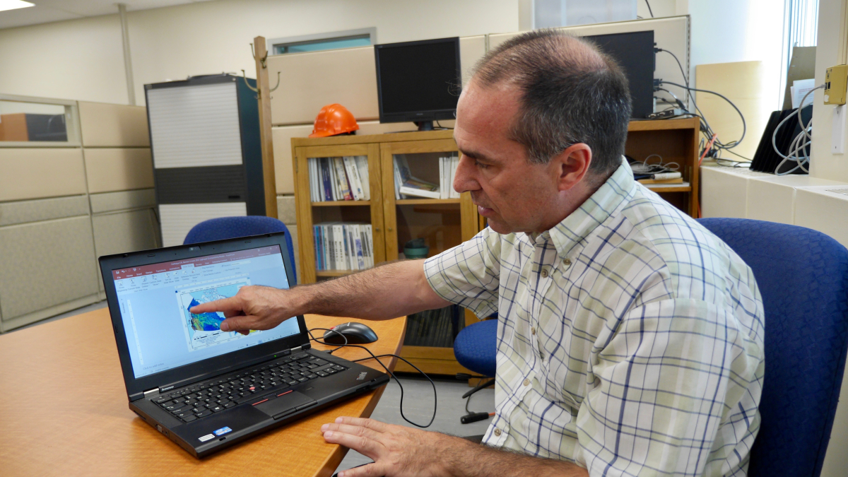
“The conditions that are driving those kinds of big fires...will be much more prevalent in the future, and they will occur much more often,” said Yan Boulanger, a research scientist in forest ecology at the service’s Laurentian Forestry Centre, and one of seven authors of a peer-reviewed study published April 12 in the scientific journal Ecological Applications.
The lethal wildfire that swept through Fort McMurray in 2016 forced 88,000 people to evacuate, the largest in Alberta history, and ravaged $3.8 billion worth of property. It raged for 15 months and burned down close to 6,000 square kilometres. Canada lost around one per cent of its entire GDP in the second quarter that year due to the fire.
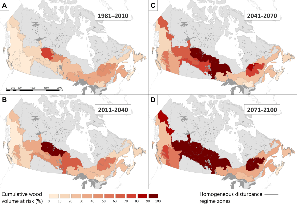
“We have a problem in big parts of Canada, when you see 100 per cent of the volume (of trees), in the worst case scenario, will probably die,” said forest ecology biologist Dominique Boucher, another author of the study. National Observer spoke with both scientists on April 18 to discuss their findings.
The worst case scenario that she was referring to would be a model that has been studied by climate scientists in which humans failed to scale back consumption of fossil fuels, leading to a global temperature rise of up to 4.8 C before the end of the 21st century.

Climate to be more 'suitable' for mountain pine beetle
The study used recent nationwide data compiled by the forest service that estimated the volume of trees across Canada in 2001. The scientists then combined this information with detailed climate projection scenarios designed by the Intergovernmental Panel on Climate Change to factor in anticipated changes in emissions, population and economic growth.
They then used these models to estimate how the boreal forest might respond to the four most critical natural disturbances it currently faces: wildfires, droughts, and two insect outbreaks — in the east, the spruce budworm, and in the west, the mountain pine beetle.
Fires and infestations are currently major issues, while drought is expected to play an increased role as climate change intensifies. "It is becoming warmer in the future, and drier," said Boulanger.
The four disturbances are driven by temperature and precipitation, both significant components of climate change. Scientists say carbon pollution in the atmosphere is warming the planet and changing the water cycle. The climate will be much more suitable for the mountain pine beetle, said Boulanger, and more suitable for large and frequent fires.
“If those natural disturbances are increasing in future, there will be a great impact on the trees themselves, on the mortality potential,” said Boulanger.
“What we found is that there is an increase in those disturbances. Timber volume will be much more at risk to mortality in the future, in some specific areas. Some places will be more affected by fire, other places will be more affected by certain insect outbreaks,” he said.

Tree risk changing in coming decades
Effectively managing Canada's boreal forest is crucial for the planet, as the country holds almost a third of Earth's boreal zone. The forests and the earth under them also support jobs and communities, provide food and resources and are home to 70 per cent of Indigenous communities.
A high risk of fire and resulting risk of tree death appears in central Quebec as early as 2040, according to the paper, titled “Current and projected cumulative impacts of fire, drought and insects on timber volumes across Canada.”
“When disturbance effects are cumulated, important changes in volumes at risk are projected to occur as early as 2011-2041, particularly in central and eastern Canada,” the paper reads.
“In our last simulation period covering 2071 to 2100, nearly all timber volumes in most of Canada’s forest regions could be at risk of being affected by at least one of the four natural disturbances considered in our analysis, a six-fold increase relative to the baseline period (1981-2010).”
Boucher said she took the models designed by Boulanger and others and studied their overlap. The scientists had to account for the interaction between the disturbances, to make sure they don’t count trees dying off twice. This is part of the novelty of the study, as earlier research looked at the threats more in isolation, they said.
As well, they had to account for dynamic factors, as climate change continues to alter the face of the planet through the century. For example, scientists already know that climate change is significantly stunting the growth of black spruce — the iconic boreal tree in Canada, stretching from one end of the country to the other — and it’s expected to stunt the growth of other trees over time.
Another dynamic factor is that the probability of tree death is affected by the frequency of wildfires in unpredictable ways. Increased fires could lead to less trees, for example, which might also mean less fuel for other fires. “We are not projecting, for example, in the future, what will be the (timber) harvest..we’re just saying...what would happen to this volume if we made it experience the climate of the future?” said Boulanger.

Safe trees could be lower than current harvests
What’s clear is that the provinces and territories, which have jurisdiction over most forests in Canada, will have to take research like this into account when planning future laws and regulations. That's because at some point during the century, the amount of timber being regularly harvested will become greater than what is beyond the reach of the disturbances studied.
“By 2100, estimated wood volumes not considered to be at risk could be lower than current annual timber harvests in central and eastern Canada,” states the paper. “Current level of harvesting could thus be difficult to maintain without the implementation of adaptation measures to cope with these disturbances.”
The study was carried out in parallel with other research by the forest service that aims to map the probability of wildfires in most permanent settlements in the boreal forest of Canada. That work, when completed, will bring more precision to this study, said Boulanger, allowing the scientists to better define particular areas where the probability of fire is greater.
Two other authors of the paper, remote sensing and spatial modeling research scientist André Beaudoin and remote sensing project manager Luc Guindon, have also been working on turning a large amount of satellite data into forest maps.
In addition to Boucher, Boulanger, Beaudoin and Guindon, the other authors are: forest vegetation ecologist Isabelle Aubin; forest productivity research scientist Pierre Bernier and forest succession research scientist Sylvie Gauthier.


Comments
Werner Kurz, a senior research scientist at the Canadian Forest Service and head of its carbon accounting team, estimated that the Fort McMurray fire alone released around 85 million tons (Mt) of carbon-dioxide-equivalent (CO2 eq) into the atmosphere in 2015. He generally estimates that for every hectare of forest consumed in a fire like this one, about 170 tons of CO2 eq emissions head into the atmosphere.
(source: The Washington Post, May 20, 2016: "The Fort McMurray fire's stunning pulse of carbon to the atmosphere")
In 2015, a total of 3.9 million hectares of forest burned in Canada. It means, according to Werner Kurz estimates, that around 663 Mt CO2 eq were emitted into the atmosphere that year. If accounted these emissions would have almost doubled total Canada's GHG emissions which were estimated at 722 Mt CO2 eq in 2015.
In a 2004 study, scientists using a coupled climate model showed that the observed increases in area burned in Canada during the last four decades was the result of human-induced climate change. Additionally, it appears that temperature was the most important predictor of area burned in Canada with warmer temperatures associated with increased area burned.
(source: www.icir.org/images/Flannigan_CIF_fire_and_cc_Nov_2_2011_pdf)
An average of 9,000 fires burn more than 2 million hectares each year in Canada. This is twice the average area burned in the early 1970's, and various modelling scenarios predict another doubling or more by the end of this century, because of warmer temperatures expected as a result of climate change.
(source: Natural Resources Canada, Dec. 04, 2013: Peatland fires and carbon emissions")
From Canada's Second Biennial Report submission to the United Nations Framework Convention on Climate Change (UNFCCC), April 2016, section 5.1 footnote: " Canada has indicated that its accounting for managed forests towards its emissions reductions target will exclude the impacts of natural disturbances because these impacts are non-anthropogenic." (As a party to the UNFCCC, Canada must report annually on GHG emissions from the managed forest, emissions from unmanaged forest are not accounted).
For greenhouse gas reporting, the "managed forest" area in Canada, made up of all forests under direct human influence, is about 226 million hectares, or 65% o Canada's total forest area. All other forest are considered to be "unmanaged".
According to Natural Resources Canada, human activities in Canada's managed forest accounted for "removals" of about 26 Mt CO2 eq in 2015, while large scale "natural disturbances" (e.g. wildfires, insect infestations) accounted for emissions of about 247 Mt CO2 eq in 2015. Total net emissions from Canada's managed forest were about 221 Mt CO2 eq in 2015.
(source: Natural Resources Canada, Sept.28, 2017, Indicator: Forest carbon emissions and removals)
This is about a third of the estimated GHG emissions made by Werner Kurz, but still represents roughly 30.6% of Canada's total GHG emissions in 2015.
Emissions from "natural disturbances" on managed land were included under the first commitment period of the Kyoto Protocol, but as Canada's forests were becoming a major "source" of GHG emissions instead of a "sink", the Harper government for that reason, and other reasons, decided to op out of the Kyoto Protocol. Since such large disturbances can cause significant liabilities for a country if expected to meet a particular quantified target, the Trudeau government also decided not to include those emissions in Canada's annual report on GHG emissions.
Thanks for the good work put in on this study, and for reporting it so thoroughly. Good incentive to make my next car an electric!
It should be noted that this has happened in Canada once already since the end of the last ice age. The prairies had been boreal forest for a few thousand years after the end of the last ice age. None of the trees that are now found in the former tall and short grass prairies were there at the time of settlement because wild fires prevented their development. Ie: Hudson Bay archives have records from the 1840's of fires so vast that they ranged from Rocky Mountain House in the foothills to Cumberland House on the SK/MB border. Two years later another one burnt everything between the Saskatchewan and Missouri Rivers. On the flip side your article also doesn't mention that warming conditions you cite will also mean that the boreal forest will likely spread north and east into the arctic too
As you are saying these episodes of burning and regeneration of forests have happened in the past, but the difference right now is that the burning of forests is happening a lot faster and the regeneration is not coming fast enough. It means that GHG emissions are growing fast.
According to Canada's "Sixth National Communication and First Biennial Report on Climate Change" to the UNFCCC ( April 2014) , "the average annual surface air temperature over Canada's landmass warmed by about 1.7ºC between 1948 and 2012, approximately twice the global average. Northern Canada (north of 60º latitude) has warmed at a rate approximately 2.5 times the global average since the late 1940's". Climate scientists around the world are showing that this warming trend is happening faster than predicted.
This accelerated warming in northern Canada has major implications. It means that permafrost is melting and releasing large quantity of methane and other greenhouse gases. It also means that peatland ecosystems are now more vulnerable to wildfires.
The combined Boreal and Subarctic regions contain 97% (142.94 billion tonnes) of the soil organic carbon mass occurring in Canadian peatlands. The peatland sensitivity model indicates that approximately 52% (74.16 billion tonnes) of the organic carbon mass in these two regions will be "severely' to "extremely severely" affected by climate change.
(source: Canadian Water Resources Journal, Charles Tarnocai, Agriculture & Agri-Food Canada, May 2009)
This is a lot of carbon. If released in the atmosphere, there is absolutely no chance that this carbon will be absorbed by oceans, which are already showing their limits, or the world's remaining forests which are declining rapidly due to human activities. You don't wish that to happen; that's why we have to limit warming the planet.